
[mkgmap-dev] map boundary error
From Mike Baggaley mike at tvage.co.uk on Thu Feb 18 00:03:32 GMT 2021
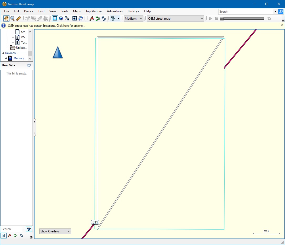
Hi all,

In creating a small test file I seem to have found an issue. The attached
OSM file has just 3 points and two ways form a right-angled triangle. In the
attached BaseCamp image, the blue line is the boundary of the map. Its
vertical lines contain the ways, but the horizontal lines do not. I can also
see that the road in the underlying base map enters into the blue rectangle,
suggesting that the blue line is not where the map boundary actually is. How
does this boundary line get created

Cheers,
Mike
-------------- next part --------------
A non-text attachment was scrubbed...
Name: bounds.jpg
Type: image/jpeg
Size: 122877 bytes
Desc: not available
URL: <http://www.mkgmap.org.uk/pipermail/mkgmap-dev/attachments/20210218/65e06dc4/attachment-0001.jpg>
-------------- next part --------------
A non-text attachment was scrubbed...
Name: test.osm
Type: application/octet-stream
Size: 664 bytes
Desc: not available
URL: <http://www.mkgmap.org.uk/pipermail/mkgmap-dev/attachments/20210218/65e06dc4/attachment-0001.obj>
- Previous message: [mkgmap-dev] FYI Population specified on admin boundaries
- Next message: [mkgmap-dev] map boundary error
- Messages sorted by: [ date ] [ thread ] [ subject ] [ author ]
More information about the mkgmap-dev mailing list